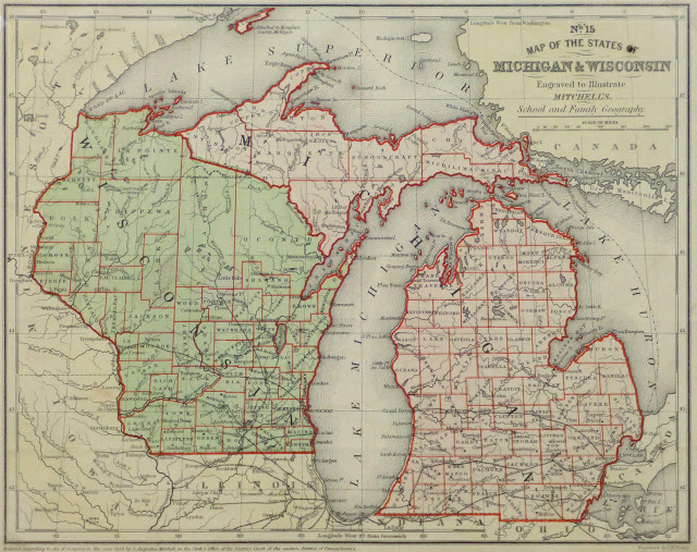
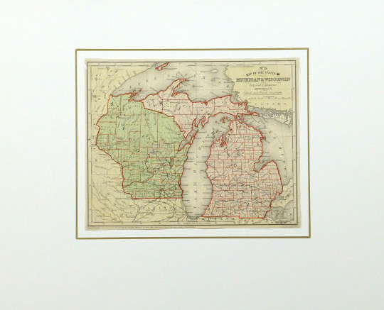
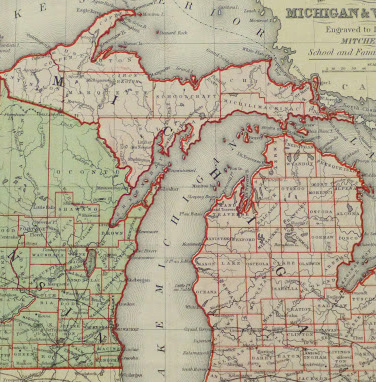


Description
Antique color engraving of a map of the states of Michigan and Wisconsin, 1860. Shows counties, railroads, rivers, lakes and towns.
Original antique map on paper displayed on a white mat with a gold border. Mat fits a standard-size frame. Archival plastic sleeve and Certificate of Authenticity included. Map, 10.5″L x 8.5″H; mat, 20″L x 16″H.