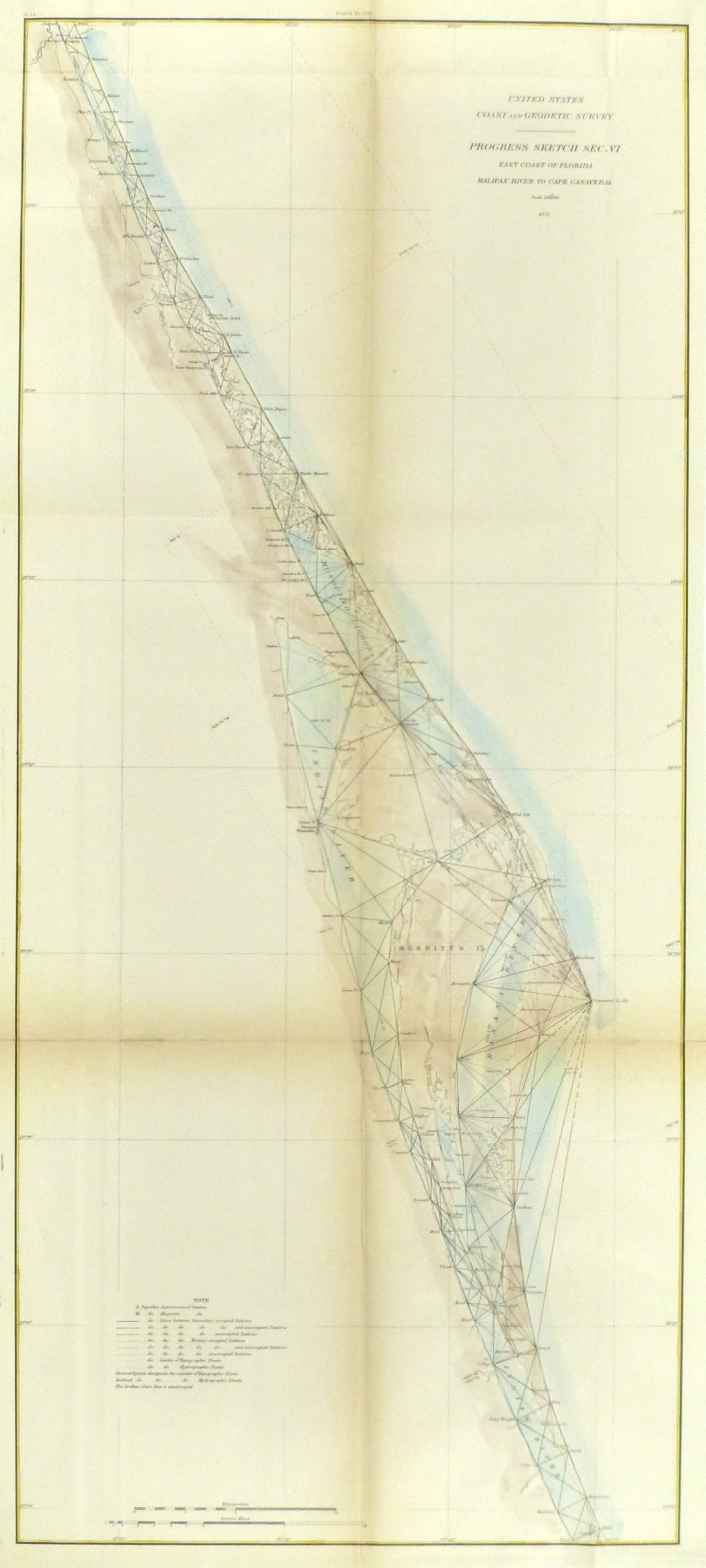
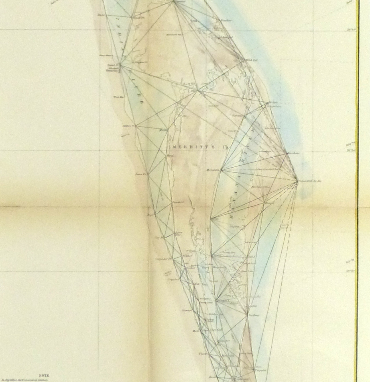
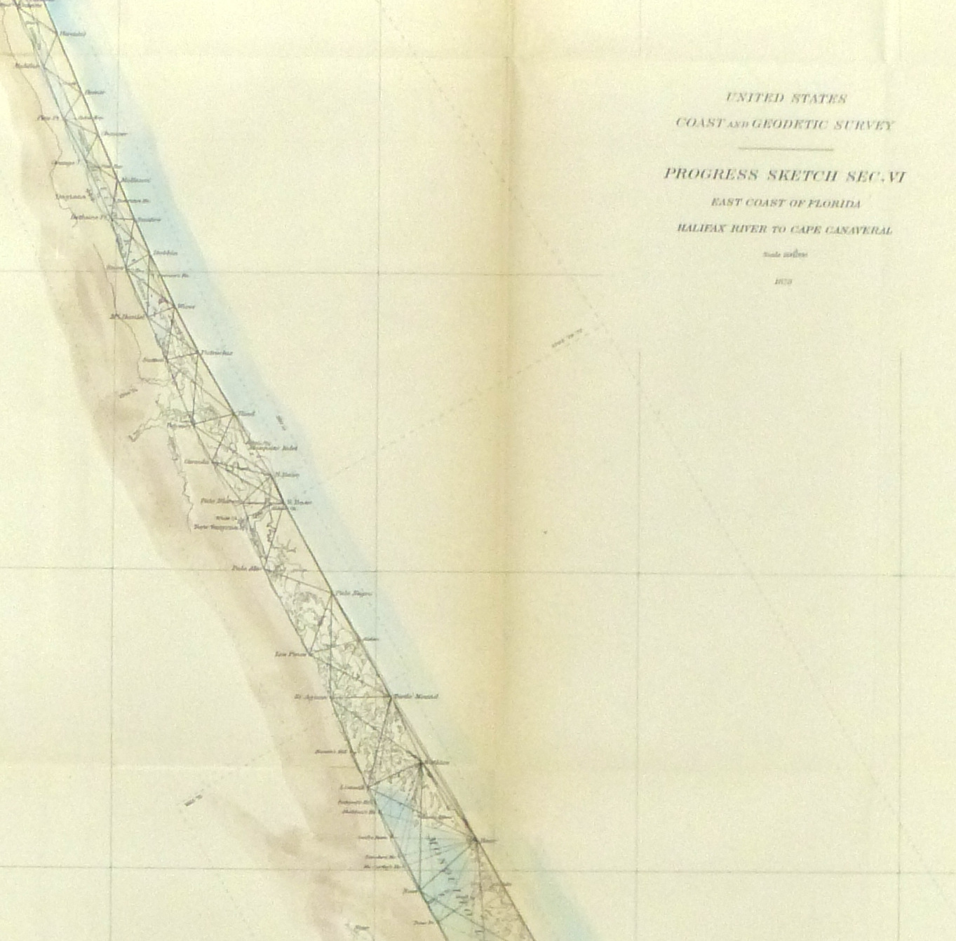


Description
Hand-colored US Coastal survey map of the east coast of Florida, from Halifax River to Cape Canaveral, 1879.
Original antique map on paper displayed on a white mat with a gold border. Archival plastic sleeve and Certificate of Authenticity included. Map, 14″L x 31″H; mat, 14.75″L x 31.75″H.