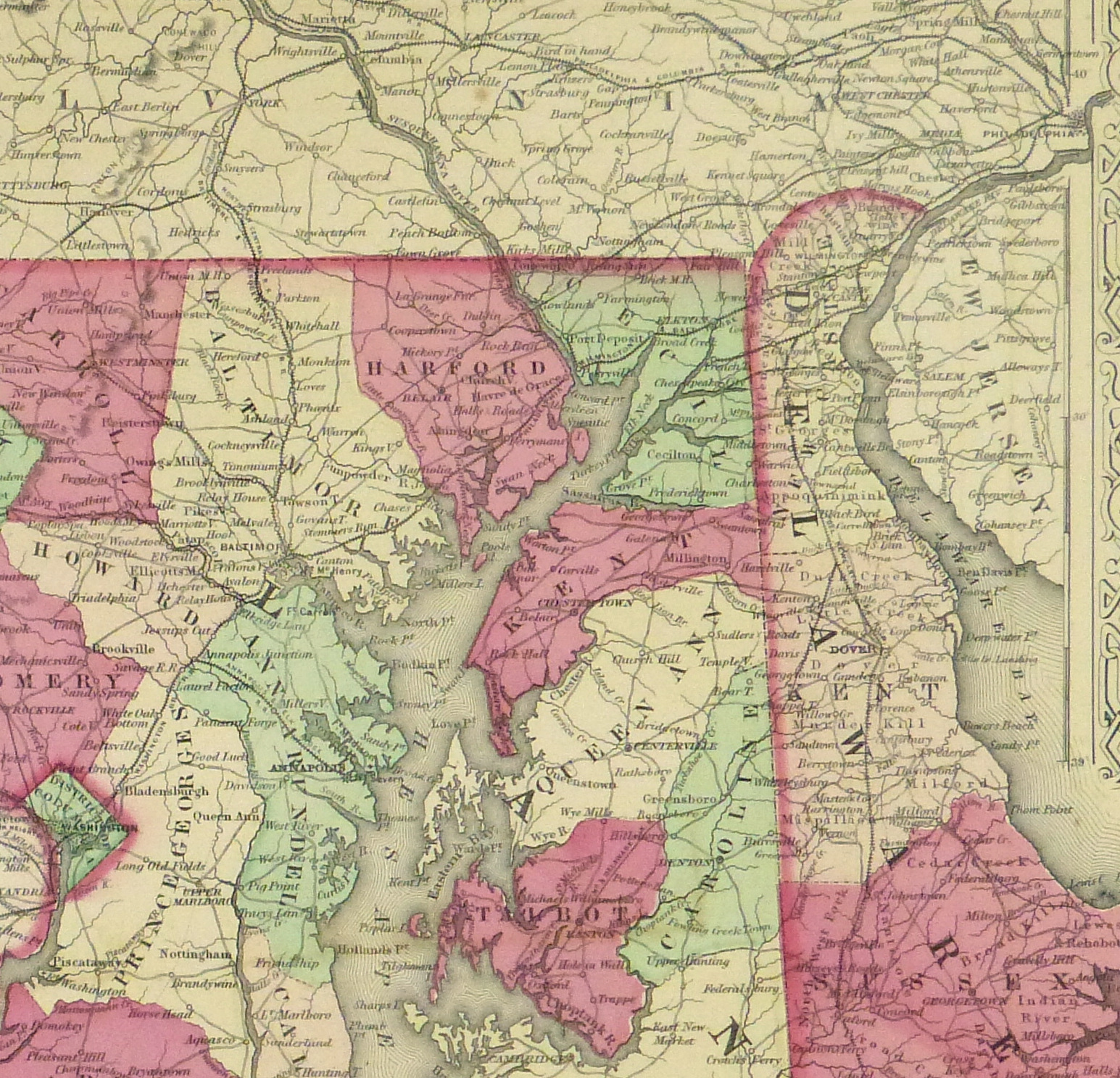


Description
Antique hand-colored map of the states of Delaware and Maryland by Johnson, 1868. Shows counties, canals, railroads, rivers and towns. Note inset map of Washington DC lower left. Ornate decorative border.
Original antique map on paper displayed on a white mat with a gold border. Mat fits a standard-size frame. Archival plastic sleeve and Certificate of Authenticity included. Map, 16.5″L x 13.25″H; mat, 24″L x 18″H.