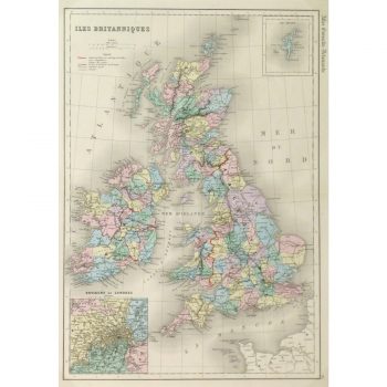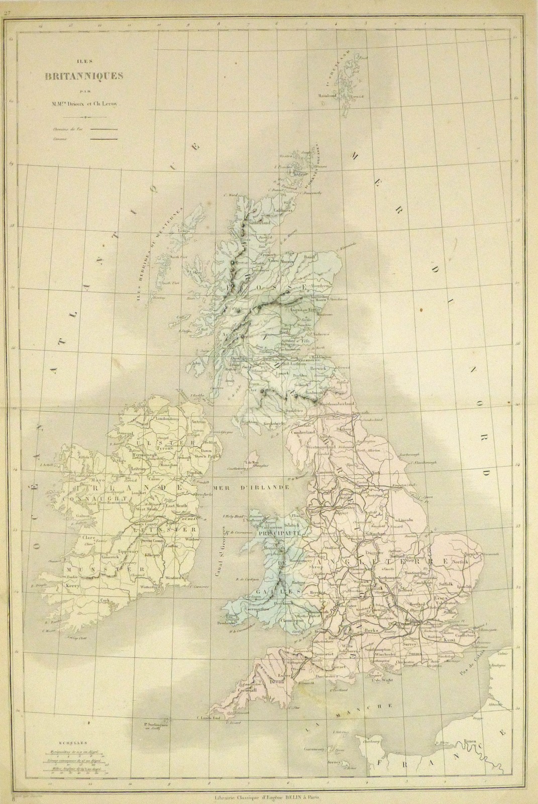
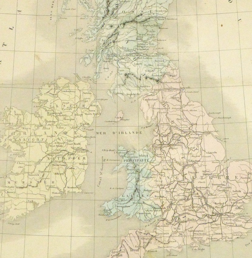


Description
Engraved map of the British Isles from 1860. Shows Ireland, Wales, Scotland, and England. Note canals and railroads. Original hand-coloring.
Original vintage map on paper displayed on a white mat with a gold border. Mat fits a standard-size frame. Archival plastic sleeve and Certificate of Authenticity included. Map, 12″L x 17.75″H; mat, 18″L x 24″H.