Medium - 16" x 20"
-
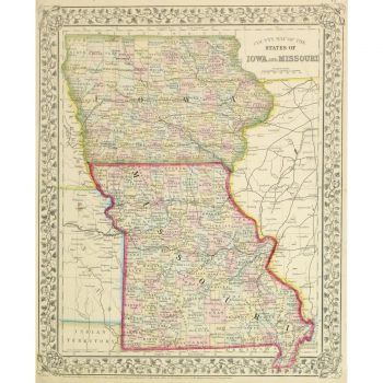
Map – Iowa & Missouri, 1867
$150.00Beautifully detailed and colorful antique map outlining the counties of the states of Iowa and Missouri by Mitchell, 1867.
-
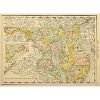
Map – Maryland & Delaware, 1887
$75.00Vibrant and highly detailed antique map of the states of Maryland and Delaware by Rand McNally, 1887.
-
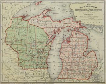
Map – Michigan & Wisconsin, 1860
$100.00 -
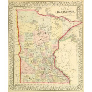
Map – Minnesota, 1867
$150.00Beautifully detailed and colorful antique map outlining the counties of the state of Minnesota by Mitchell, 1867.
-
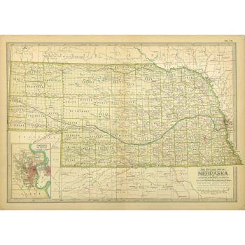
Map – Nebraska, 1897
$100.00Finely detailed antique map of the state of Nebraska, includes an inset of Omaha, from Century Atlas, 1897.
-
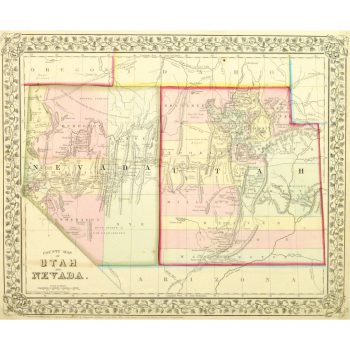
Map – Nevada & Utah, 1867
$165.00Beautifully detailed and colorful antique map outlining the counties of the states of Nevada and Utah by Mitchell, 1867.
-
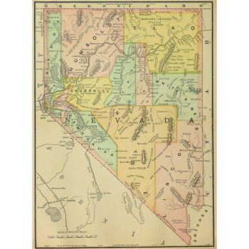
Map – Nevada, 1891
$75.00Brightly accented antique map of the state of Nevada from Encyclopedia Britanica, 1891.
-
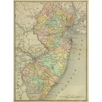
Map – New Jersey, 1891
$75.00Colorfully accented antique map of the state of New Jersey from Encyclopedia Britanica, 1891.
-
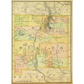
Map – New Mexico, 1891
$75.00Light but brightly colored antique map of the state of New Mexico from Encyclopedia Britanica, 1891.
-
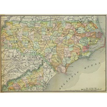
Map – North Carolina, 1891
$75.00Vividly accented antique map of the state of North Carolina from the Encyclopedia Britanica, 1891.
-
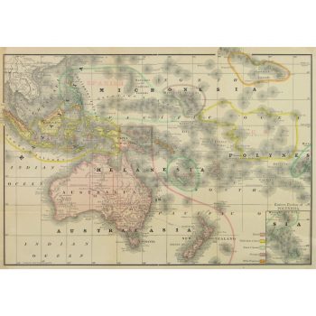
Map – Oceania, 1891
$100.00Excellent and brightly accented map of the Oceania region of the Pacific Ocean from Encyclopedia Britanica, 1891.
-
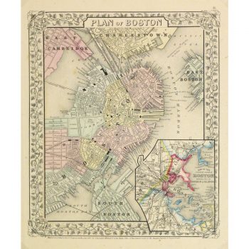
Map – Plan of Boston, 1867
$159.00Beautifully detailed and colorful antique map of the city of Boston includes an inset of the Boston Harbor Islands by Mitchell, 1867.
Showing 1729–1740 of 2571 results