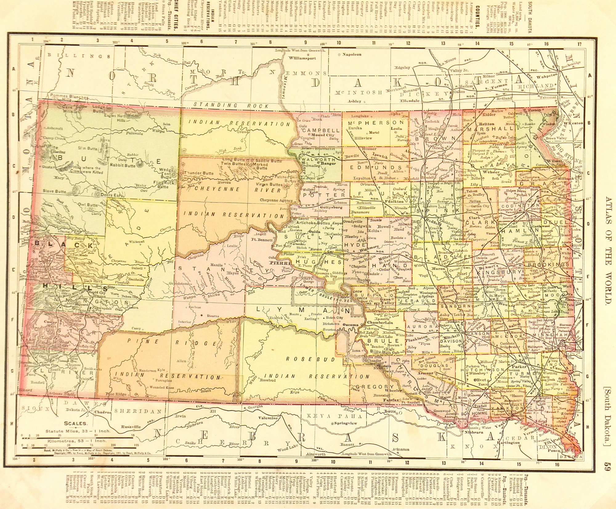
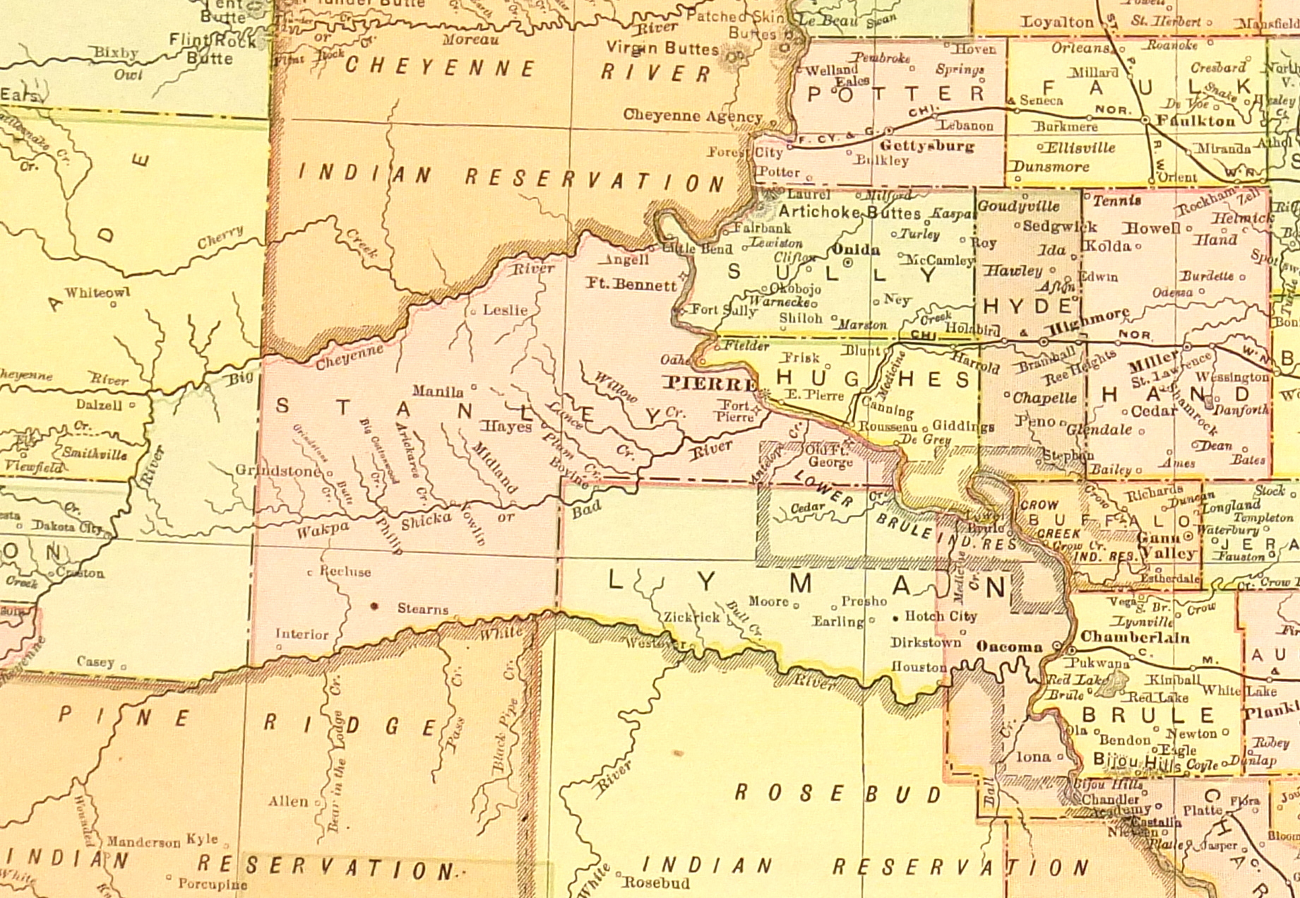
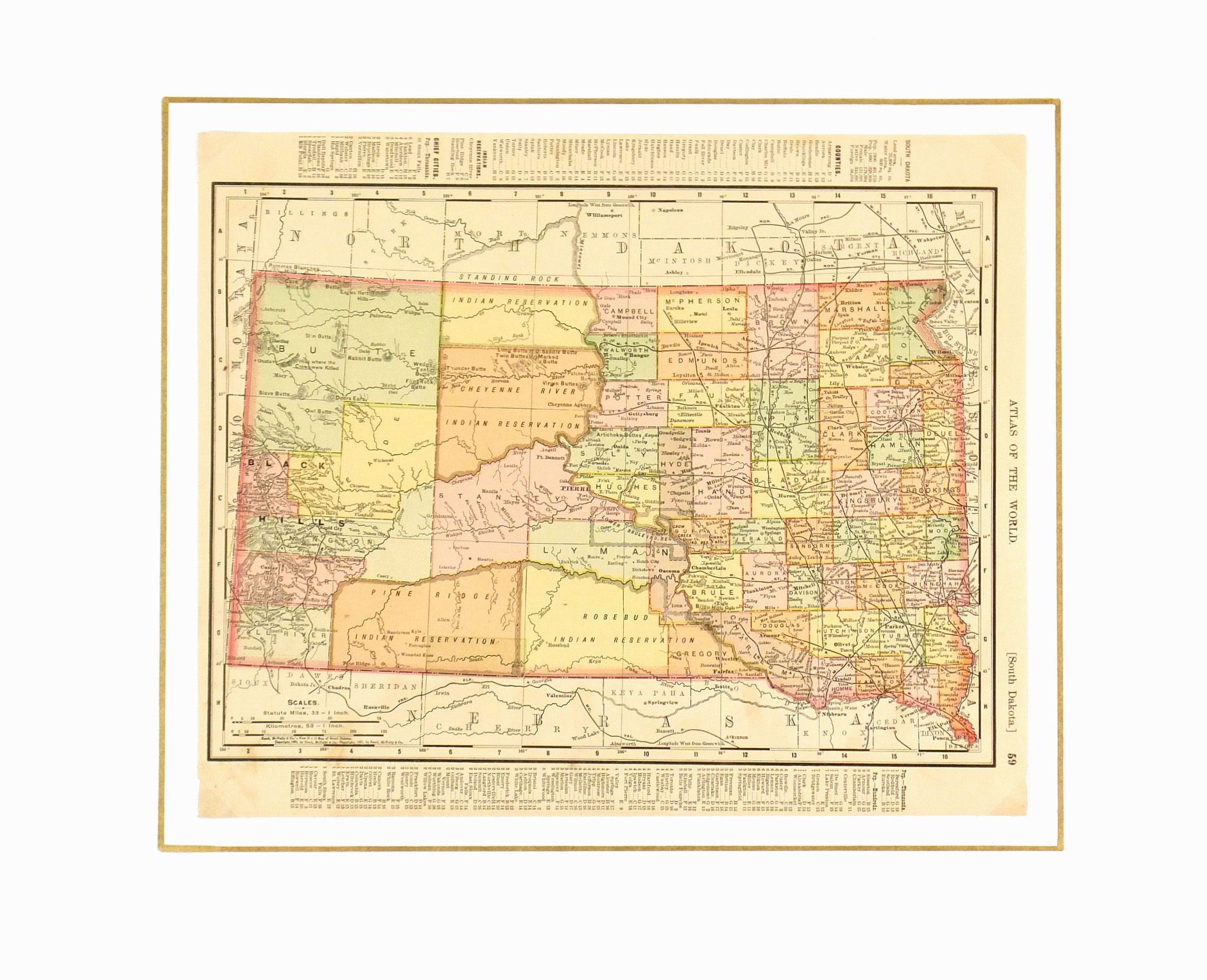


Description
Antique color map of South Dakota, 1901. Map includes counties, towns, railroads, and Indian reservations. Note the fascinating population statistics in the lower margin.
Original antique map on paper displayed on a white mat with a gold border. Mat fits a standard-size frame. Archival plastic sleeve and Certificate of Authenticity included. Artwork, 13.25″L x 11″H; mat, 20″L x 16″H.